
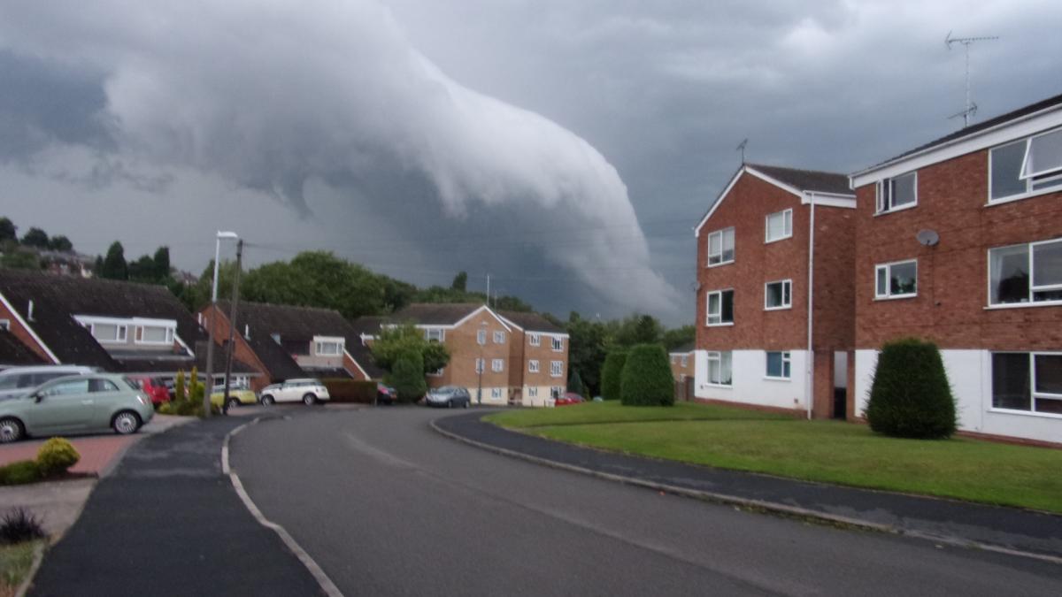
IS this the beginnings of a Tornado above the skies of Halesowen and Dudley?
An eagle-eyed Halesowen News reader with a passion for meteorology believes so.
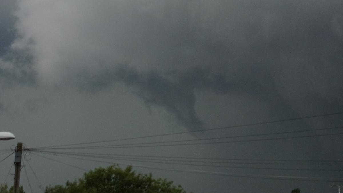
David Cooper took the remarkable snaps during the storm on Saturday evening and believes he captured a tornado's distinctive funnel.
He said: "During Saturdays evening storms I took several photographs of what appears to be a wall cloud underneath the main cloud with a distinctive funnel shape.
"I have an interest in meteorology and have often seen pictures like this associated with tornadoes in America."
He added: "The tornado could have formed but not touched the ground - this is common.
"The UK gets a lot of tornadoes, usually measuring around F1 - nothing like the US ones but still enough to take a roof off."
Thankfully Halesowen and Dudley borough remained unscathed on Saturday, but how close did we come to a tornado?


Comments: Our rules
We want our comments to be a lively and valuable part of our community - a place where readers can debate and engage with the most important local issues. The ability to comment on our stories is a privilege, not a right, however, and that privilege may be withdrawn if it is abused or misused.
Please report any comments that break our rules.
Read the rules hereLast Updated:
Report this comment Cancel